
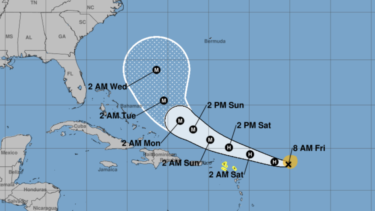
Tropical Storm Erin is likely to become Hurricane Erin on Friday as it continues its journey across the Atlantic.
The National Hurricane Center is currently predicting the storm to turn north and curl away from United States east coast without ever making landfall. Spaghetti models, which represent a collection of predicted paths generated by multiple computer models, currently support these predictions.
However, the NHC predicts the storm is likely to bring several inches of rain to Puerto Rico and encourages residents there to monitor Erin’s progress.
Mashable Light Speed
This Tweet is currently unavailable. It might be loading or has been removed.
As of Friday morning, Tropical Storm Erin is just under hurricane status with 70 mph sustained maximum wind speeds. It’s currently located 520 miles east of the Northern Leeward Islands and is traveling west-northwest at 17 mph, according to the 8 a.m. ET Friday NHC forecast.
The latest forecasts, updated multiple times daily, can be tracked online on the National Hurricane Center website.

